Tag Archives: Arctic

October 15: M’Clure Strait…Into the Ice!


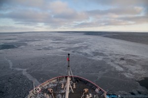
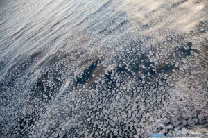
The day started out much the same way as the day before ended, with us steaming.  But within a few hours, we were beginning to see newly forming pancake ice!  There is nothing on this earth that is as beautiful as sea ice and if I needed reaffirmation of that, I got it today as we steamed through endless pancake ice to our next station inside M’Clure Strait.  As we approached Banks Island and the promontory that marked the opening to the Strait, the ice became a bit thicker and there was a quiet excitement to be sampling in this new and exciting area so far north.


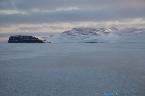
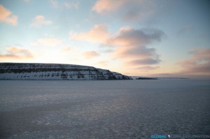
Ice with Cape M’Clure in the distance

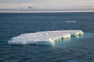
Pancake Ice

We continued around Cape M’Clure and into the Strait where we were going to sample, getting only 700 meters from shore for our first sampling station.  The sun was shining and it has to be one of the most beautiful places I have ever been.  With pancake ice forming before our eyes and yellow glowing cliffs, we watched the sun set over the cliff as we positioned the boat.  Truly a magical spot and to think about how few people have been here and the explorers that came here so long ago blew my mind.  Then it got dark and the moon was out and shining brightly, reflecting on the ice.  Only one word can describe this place: stunning.  Hard to put into words, but very special…as one person said, we are in a remote and special place…I couldn’t say it better…

Looking into the Strait: Cape Crozier

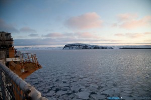
Out of the Strait: Cape M’Clure

Larger Pancake Ice as we headed to our sampling station

At our sampling station, only 700m from shore

The sun setting behind Banks Island

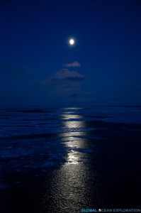
A beautiful Arctic night


October 7: Distributed Biological Observatory

Shortly after midnight, with the lights of Barrow glowing in the distance, we arrived at our next sampling line, the DBO line.


Deploying the CTD rosette with Barrow glowing in the distance


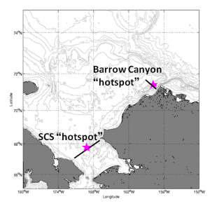
The DBO or Distributed Biological Observatory is an Arctic biological time series designed by Dr. Jackie Grebmeier from the University of Maryland (http://arctic.cbl.umces.edu/) to look at core oceanographic parameters such as temperature and nutrients in regional hotspots in the Arctic throughout the year.  This line consists of eight stations in the waters just offshore of Barrow crossing Barrow Canyon.  This time series is based on the cooperation of various research ships from the USA, Canada, Russia, China and Japan, committing to sample this line when they are operating in the Chukchi Sea.  I wanted to make sure to highlight the DBO in the blog because of the magnitude of importance of this kind of multi-national cooperation amongst scientists.  This collaboration and cooperation allows the collection of a tremendous data set that creates an annual and seasonal time series that will be able to quantify the changes to this important Arctic Ocean ecosystem in the face of climate change.


Map of DBO Lines (from http://pag.arcticportal.org)


October 6: First Sampling

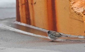
Slate-Colored Junco (Photo credit: Luke DeCicco/USFWS)


In the wee hours of the morning, we began the CTD casts along our first transect and continued to sample throughout the night until the late morning when it was time to retrieve a mooring.  The mooring had been deployed last year in order to record salinity, temperature and a variety of other physical parameters of the water.  The scientists are excited to retrieve their instruments and find out what has happened in the year since its deployment.


It is kind of a cloudy and cold day with snow dusting the decks but we still are experiencing calm seas.  There have been quite a few birds surrounding the ship including a songbird, a Slate-Colored Junco, a subspecies of the Dark-Eyed Junco, that must have lost its way from its home in the arboreal forest.  One of my favorite things about being at sea is discovering these little creatures seeking refuge on the ship after they have lost their way.  This little guy hung out on the boat for a while before hopefully heading south out of the Arctic.  They are not often spotted this far north so he had certainly lost his way.


June 29: Final Day of Sampling


On this final day of sampling, we found ourselves back up north…farther north than before.  It seems that every day we steam north to start the sampling.  The reason for this is to keep up with the migration of the salmon post-smolts.  They are funneling along the shelf here off of the Voering Plateau moving with the northerly current. 

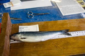
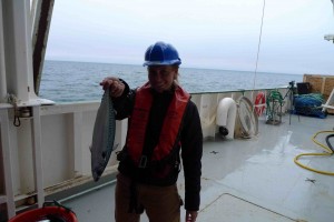
With the anticipation of heading back to port, everyone was excited to have a great day here on the calm Norwegian Sea.  With the net in the water, the sun came in and out most of the day and finally stuck around for the entire haul of the last tow.  With the sun shining, the birds were soaring around the ship and the final haul came in yielding a fair number of post-smolts along with an escaped hatchery fish.  This adult fish was in very good condition but had been eating seaweed because it looks like fish pellets.  This is not a nutritious substitute for the small fish and plankton the fish should be eating. 


An adult salmon from the trawl.

We are now steaming back to Killybegs from above the Arctic Circle.  It should be a two and half day steam.  Hopefully the seas will stay calm.

The evening brought a beautiful sunset as we passed below the Arctic Circle.  The sun disappeared behind a bank of fog before we could see it skim across the horizon as it would up here, but it was a stellar evening nonetheless.  


Sampling Hours in the Ocean of the Midnight Sun


One thing I find interesting on this cruise is that we only sample in so-called daytime hours.  Despite the fact that we are above the Arctic Circle and have 24 hours of sunlight, the fish still sense the change in time of day.  It is not the darkness that determines the fish behavior but the angle of the sun and light penetration into the water has an effect because of the albedo, the reflectivity of the light on the water.  Even though we are in the land (or ocean) of the midnight sun, the fish still move to deeper waters at night.  For this reason, we begin sampling in the early morning and end in the late evening noting that our highest concentration of fish are caught in the middle of the day. 

We are also finding very small concentrations of plankton in the area.  This is peculiar but apparently has been the case in this region of the Norwegian Sea for some time now.  One theory is that the abundance of the small pelagic species, herring, mackerel, etc is leading to over-grazing driving the populations down.  This will eliminate food for the young salmon on their way to grow and fatten up in the north before heading back to their natal rivers. 

There is so much to learn about the Atlantic Salmon and the possible reasons why they are getting “Lost at Sea.”  We are only just skimming the surface of our understanding and this cruise and the other SALSEA cruises are seeking to answer the question of what is happening to the post-smolt salmon that are leaving the rivers when they enter the ocean…


June 26: Northernmost Point of the Cruise (or is it?)- Sampling Begins


In the early morning (0330), We reached the anticipated northernmost point of the cruise, 67.5°N, the starting point for the sampling.  The cruise plan was to head to this point and see what we find.  If we found a large number of salmon, we would continue north.  So with a CTD done and a plankton sample collected, the first trawl of the cruise was put out for one hour to test the waters.  In this first haul, we found only one post-smolt so it was determined that we should turn southward to continue our sampling for the day in as Southerly direction.  Our second haul was far more productive yielding 50+ salmon. 

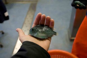
In addition to the post-smolt salmon, the net captured a few other species that were sampled as well: mackerel, herring and lumpsuckers.  Lumpsuckers are one of my favorite fish.  I don’t know much about them but they are absolutely beautiful with a crazy turquoise coloration and textured body.  The mackerel are in large numbers as we see them on the surface.  The population of mackerel and herring in this region is healthy and almost over-abundant due to the intense management of the stocks in the past years. 

A small lumpsucker

A Large Mackerel

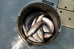
Herring (these made their way into the galley for breakfast)


We are in international waters.  As we headed south, we encountered the Russian trawler fleet, targeting the large mackerel shoals we are seeing on the surface of the sea.  These ships are massive, well over 100 meters.  One possibility for the loss of the salmon at sea is that large numbers are being discarded as bycatch.


Our sampling trawls stay out for about 3 hours.  In that time, there is ample time to spend on the bridge looking for passing wildlife.  There were some sperm whales cruising by the boat and someone sighted some orca as well.  I missed the orca but saw the sperm whales.  Apparently because of the ridge here, we should see quite a few whales and the sperm whales seem to like this area very much.  I hope at least one of the whales wants to check out this big green boat so that I can have a closer look at him. 

With the day of sampling completed, we will turn and head back north to begin sampling in the morning at a spot close to where we began today.  The smolts are moving at approximately 15 nautical miles per day so we must anticipate this movement when choosing where to sample.  Essentially, we are looking for the highest concentration of post-smolts along our journey. 

Â