Category Archives: Ocean Acidification

UPDATED WEBSITE!!!


At long last, the Global Ocean website has been updated!!!  It is now iPad and iPhone friendly and there is new work up.  Check out the gallery for “Global Catch: Portraits of a Precious Resource” which recently closed as a solo exhibition at the Liman Gallery in Palm Beach.  Have a look at all of the other improvements…Come Aboard and Explore!


globaloceansite

Arriving in Dutch Harbor…The End of the Expedition


On October 27, the snow-dusted peaks of Dutch Harbor appeared in the distance and I knew that the expedition was coming to a close. Cruising through the Southern Bering Sea, there were many birds including fulmars, albatross and a variety of gulls soaring indicating that we were back in the prolific waters of the Bering Sea.  The abundance of fishing vessels on the radar indicated that we were in the midst of crab fishing season and that we were nearing “civilization.”  Until the 26th when we entered the crab fishing grounds, there were no other vessels in any proximity to the Healy for weeks.  As we pulled into Dutch Harbor, I was struck by the beauty of the Aleutians with mountains rising out of the water protecting this vital Alaskan port.  It is a truly beautiful place with eagles soaring and otters frolicking.  The sun came out illuminating the mountains.  After passing Priest Rock, we turned and could see the low buildings of Dutch Harbor and Unalaska.  Upon completing a successful mission, we returned to port and felt dry land for the first time in four weeks.


The view from the airport parking lot before flying home…Goodbye Dutch Harbor…


October 25-27: Transiting through the Bering Sea


After a four-day steam through big stormy seas, we are finally approaching Dutch Harbor and should arrive the afternoon of the 27th.  I am using this time to finish up some work and pack up all of my equipment.  All of the scientists are also packing and the lab is beginning to look barren as we are all getting ready to head home.

It is nice to be back in the Bering Sea with abundant birds flying by the ship.  In the Arctic Ocean, I was amazed by the dearth of bird life which only highlighted how extreme and harsh the conditions are so far north, but once we passed through the Bering Strait, the bird life became much more abundant.


Big Seas in the Bering…


The Beautiful Bering Sea


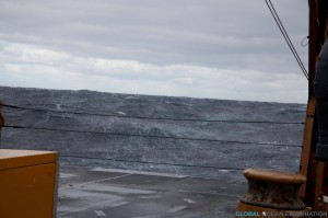
We are in our final transit day to Dutch Harbor and we are witnessing the Bering Sea in all her glory with rough seas and strong winds.  It is magnificent to see the Bering Sea like this with waves going every which direction and a fierce wind blowing.  We are getting into Dutch tomorrow afternoon and enjoying every minute of this display of power.  Although being rocked about is a little tiring.


A wave behind the stern of the ship…we have a following sea…a VERY big one at that!


October 23 & 24: Transiting to Dutch…


October 23rd was another rough day up here in the Arctic Ocean with high winds and big swells making operations difficult.  It also marked the end of the scientific mission as it was time to begin our transit back to Dutch Harbor.  The transit to Dutch will take about four days of steaming west through the Chukchi Sea, south through the Bering Strait and then south through the Bering Sea to Dutch Harbor.  We are hoping for some calmer seas, but it looks like storms are in the forecast.


Click Photo Above to Play Video of the Seas…


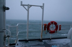
Sure enough on October 24th, I woke up to everything in my cabin sliding around and the momentary fear that I had not secured all of my cameras and equipment.  Knowing that the seas were going to build, I had put everything away but when those big rollers hit, flashes of flying cameras and computers went through my mind.  In the morning, we saw 50 Knot winds and 15-18 foot swells.  With all decks secured, I was forced to watch the power of Mother Nature from the bridge and aft control room.  It was intense with water sloshing over the fantail and up to the first deck of the boat.  Throughout the day, the seas and winds calmed a bit and hovered around 25 knots as we approached the Bering Strait in the evening.  We passed back south of the Arctic Circle and will enter the Bering Sea during the night.


October 22: Rough Seas


Rough seas are the story of the day.  I woke up with a start this morning at 4am with a huge roll that nearly threw me from my bunk.  It is blowing more than 30 knots and building with 10-12 foot seas and the Healy is rocking and rolling.  In conditions like these, scientific operations stop and we just have to wait out the weather.  I have to say that the ocean looks magnificent in power and fury, but walking to the lab this morning, I felt like I was nearly going to blow away.  Despite the storm, the Ross’s Gulls were still soaring among the waves along with a few other Arctic birds.  Not a great day to do science, but so awesome to witness seas like this firsthand!


October 21: “Apex of Avian Awesomeness”


Ross’s Gull (Photo: Luke DeCicco, USFWS)

As we reached our sampling site in Barrow Canyon, I received a message from the bird observer, Luke DeCicco, telling me to come up to the bridge immediately.  The last message I received from Luke to come to the bridge was to tell me about the Snowy Owls so I knew this was going to be good.  I was right as flying around the ship were flocks of Ross’s Gulls.  Ross’s Gulls are found only in the Arctic and very rarely go south of the Bering Strait.  The only way to see them in North America is at sea in the Arctic Ocean or off of Barrow in the fall.  They are tied closely to the ice edge and Luke had been anxiously looking for them the entire cruise.  He got his long awaited glimpse of what he called the “apex of avian awesomeness” with hundreds of Ross’s Gulls flying north by the ship all day.  He was in heaven and with one glimpse of these little gulls, I knew why.  Small in size, the birds have a very interesting coloration with a lavender grey back and wings and a pink breast.  The pink plumage, derived from their diet of krill and other plankton, is the same pink that glows in the sky at sunset and the grey is that of the Arctic sky.  A perfectly adapted little bird for their environment, I was excited to see these birds, another unique species to the Arctic!  Thanks Luke for the great photos!


(Photo Credit: Luke DeCicco, USFWS)


October 20: Aurora Borealis


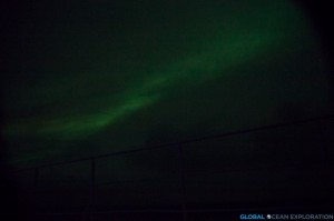
With the sampling by the Mackenzie River finished, it was time for us to continue steaming to the west back towards Barrow Canyon to finish up some work there before heading back to Dutch Harbor.  It was a foggy and snowy day with a long steam ahead of us.  In the evening, the skies cleared and the Northern Lights, Aurora borealis, illuminated the sky in a stunning display.


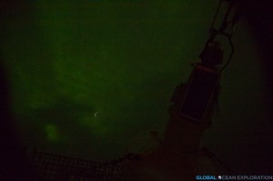
I have always dreamed about seeing the Northern Lights or Aurora Borealis and knowing that we are so far north and in prime Aurora season, I have made it a nightly ritual to go out on deck to check for clear skies.  On a few evenings, the clouds have parted and the skies were illuminated with the shimmering green of the Aurora.  I am very excited to have seen the Aurora on a few occasions on this cruise although have found photographing the Aurora from a moving ship to be quite challenging.  I can now add the Aurora to the unique and extraordinary things I have seen on this expedition which have left me yearning for more time up here.


The Aurora with a silhouette of a buoy on deck


October 18 & 19: Mackenzie River Sampling


After completing our stations at the mouth of Amundsen Gulf, we transited to our next sampling area in the waters off of the Mackenzie River.  We are sampling here to determine the role of freshwater from the river on the acidity of the ocean.  The Mackenzie River is the largest river emptying into the Beaufort Sea; the only other being the Colville River which is one-tenth the size of the Mackenzie.  Therefore the freshwater input from the Mackenzie may play an important role in the ocean chemistry of the Beaufort Sea and Arctic Ocean.  The low alkalinity water from the river and high pCO2 (partial pressure) leads to decreased buffering capacity and higher acidity in the coastal waters.


While sampling near the river mouth, the water was clearly filled with silt from the river and the freshwater signal was high indicating that the river is playing an important role in the ocean chemistry of the area.


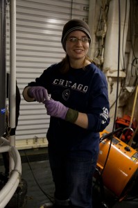
Profile: Stacey Reisdorph


The other half of the dynamic duo working with Dr. Mathis is Stacey Reisdorph, a master’s student at the Ocean Acidification Research Center (OARC).  From Iowa, Stacey has come a long way since her first time at sea on a Disney Cruise in 2009 as she immerses herself in the world of chemical and geological oceanography in the waters off of Alaska.

Starting off studying early childhood and elementary education at the University of Northern Iowa, Stacey soon learned that her passions lay elsewhere.  With the encouragement of her family and a fantastic geology professor, Stacey became a geology and earth sciences double major and had found her passion.  When it came time to apply to graduate school, Stacey fulfilled her dream of moving to Alaska when she was accepted into a master’s program in glaciology at University of Alaska-Fairbanks.  However, Stacey soon decided that she wanted to do something a little different and found a new home with Dr. Sam VanLaningham who suggested she start working with Dr. Mathis on a new and very exciting project in Glacier Bay.

After a little bit of bouncing, Stacey found a home in the Mathis Lab at OARC in January 2011 and is quickly becoming a chemical oceanographer as she delves into the water chemistry of Glacier Bay, a treasured National Park and home to many whales, sea lions, and otters.  Working closely with the Park Service, Stacey heads to Glacier Bay once a month to sample a series of stations for dissolved inorganic carbon, alkalinity, oxygen isotopes, nutrients, dissolved oxygen, total suspended sediments and particulate organic carbon.  Stacey is adding water sampling data to a time series of CTD data that has been collected since the early 1990s.

Glacier Bay is of particular interest because with climate change there is an increase in glacial meltwater entering the ecosystem leading to changes in the water chemistry.  Glacial meltwater is low in alkalinity and therefore decreases the ability of the water to buffer against acidification.  With this valuable time series of data, Stacey hopes to understand the dynamics and circulations patterns of the water from the mouth of the Bay to the freshwater sources throughout the year.