Â
In the early morning (0330), We reached the anticipated northernmost point of the cruise, 67.5°N, the starting point for the sampling. The cruise plan was to head to this point and see what we find. If we found a large number of salmon, we would continue north. So with a CTD done and a plankton sample collected, the first trawl of the cruise was put out for one hour to test the waters. In this first haul, we found only one post-smolt so it was determined that we should turn southward to continue our sampling for the day in as Southerly direction. Our second haul was far more productive yielding 50+ salmon.Â
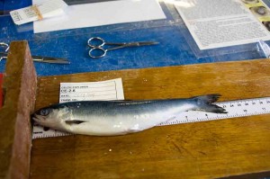
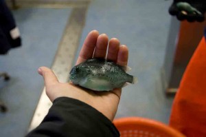
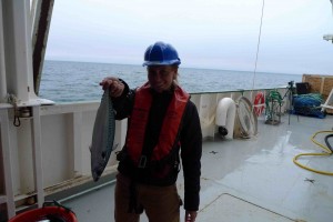
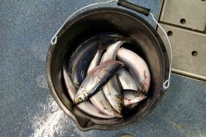
In addition to the post-smolt salmon, the net captured a few other species that were sampled as well: mackerel, herring and lumpsuckers. Lumpsuckers are one of my favorite fish. I don’t know much about them but they are absolutely beautiful with a crazy turquoise coloration and textured body. The mackerel are in large numbers as we see them on the surface. The population of mackerel and herring in this region is healthy and almost over-abundant due to the intense management of the stocks in the past years.Â
A small lumpsucker
A Large Mackerel
Herring (these made their way into the galley for breakfast)
Â
We are in international waters. As we headed south, we encountered the Russian trawler fleet, targeting the large mackerel shoals we are seeing on the surface of the sea. These ships are massive, well over 100 meters. One possibility for the loss of the salmon at sea is that large numbers are being discarded as bycatch.
Â
Â
Our sampling trawls stay out for about 3 hours. In that time, there is ample time to spend on the bridge looking for passing wildlife. There were some sperm whales cruising by the boat and someone sighted some orca as well. I missed the orca but saw the sperm whales. Apparently because of the ridge here, we should see quite a few whales and the sperm whales seem to like this area very much. I hope at least one of the whales wants to check out this big green boat so that I can have a closer look at him.Â
With the day of sampling completed, we will turn and head back north to begin sampling in the morning at a spot close to where we began today. The smolts are moving at approximately 15 nautical miles per day so we must anticipate this movement when choosing where to sample. Essentially, we are looking for the highest concentration of post-smolts along our journey.Â
Â

