Category Archives: Ireland

June 27: Day 2 of Sampling- South and North


With an early start to the day (0500), back up to the north, the CTD was in the water.  The trawl was in and fishing by 0600 for a three hour tow.  At 0900, the tow came up and was as expected with a nice concentration of post-smolts although they are quite small.  The trawl went out again for four hours on the second tow but the haul had far fewer fish than anticipated.  With that in mind, we steamed north a bit for the third tow.  We are kind of zigzagging along a contour in order to find higher numbers of post-smolts. 


After ending the day with a smaller number of post-smolts, we are steaming farther north to sample tomorrow into the northerly current.  We should be above 68°N in the morning to begin sampling so in fact our first proclamation of the northernmost point of the voyage will be incorrect. 

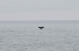
The day was filled with quite a bit of wildlife though.  We saw a few sperm whales cruising on the surface in addition to two minke whales and a fin whale.  There are quite a few fulmars following the ship as well. 


Sperm Whale Fluke

A fulmar soaring past the ship


I am quite excited to be heading so far north.  Perhaps we will get some sunshine but the fog is rolling in so it is not looking promising.  


Sampling Hours in the Ocean of the Midnight Sun


One thing I find interesting on this cruise is that we only sample in so-called daytime hours.  Despite the fact that we are above the Arctic Circle and have 24 hours of sunlight, the fish still sense the change in time of day.  It is not the darkness that determines the fish behavior but the angle of the sun and light penetration into the water has an effect because of the albedo, the reflectivity of the light on the water.  Even though we are in the land (or ocean) of the midnight sun, the fish still move to deeper waters at night.  For this reason, we begin sampling in the early morning and end in the late evening noting that our highest concentration of fish are caught in the middle of the day. 

We are also finding very small concentrations of plankton in the area.  This is peculiar but apparently has been the case in this region of the Norwegian Sea for some time now.  One theory is that the abundance of the small pelagic species, herring, mackerel, etc is leading to over-grazing driving the populations down.  This will eliminate food for the young salmon on their way to grow and fatten up in the north before heading back to their natal rivers. 

There is so much to learn about the Atlantic Salmon and the possible reasons why they are getting “Lost at Sea.”  We are only just skimming the surface of our understanding and this cruise and the other SALSEA cruises are seeking to answer the question of what is happening to the post-smolt salmon that are leaving the rivers when they enter the ocean…


June 26: Northernmost Point of the Cruise (or is it?)- Sampling Begins


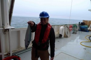
In the early morning (0330), We reached the anticipated northernmost point of the cruise, 67.5°N, the starting point for the sampling.  The cruise plan was to head to this point and see what we find.  If we found a large number of salmon, we would continue north.  So with a CTD done and a plankton sample collected, the first trawl of the cruise was put out for one hour to test the waters.  In this first haul, we found only one post-smolt so it was determined that we should turn southward to continue our sampling for the day in as Southerly direction.  Our second haul was far more productive yielding 50+ salmon. 

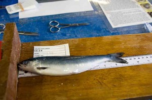
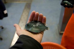
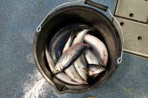
In addition to the post-smolt salmon, the net captured a few other species that were sampled as well: mackerel, herring and lumpsuckers.  Lumpsuckers are one of my favorite fish.  I don’t know much about them but they are absolutely beautiful with a crazy turquoise coloration and textured body.  The mackerel are in large numbers as we see them on the surface.  The population of mackerel and herring in this region is healthy and almost over-abundant due to the intense management of the stocks in the past years. 

A small lumpsucker

A Large Mackerel

Herring (these made their way into the galley for breakfast)


We are in international waters.  As we headed south, we encountered the Russian trawler fleet, targeting the large mackerel shoals we are seeing on the surface of the sea.  These ships are massive, well over 100 meters.  One possibility for the loss of the salmon at sea is that large numbers are being discarded as bycatch.


Our sampling trawls stay out for about 3 hours.  In that time, there is ample time to spend on the bridge looking for passing wildlife.  There were some sperm whales cruising by the boat and someone sighted some orca as well.  I missed the orca but saw the sperm whales.  Apparently because of the ridge here, we should see quite a few whales and the sperm whales seem to like this area very much.  I hope at least one of the whales wants to check out this big green boat so that I can have a closer look at him. 

With the day of sampling completed, we will turn and head back north to begin sampling in the morning at a spot close to where we began today.  The smolts are moving at approximately 15 nautical miles per day so we must anticipate this movement when choosing where to sample.  Essentially, we are looking for the highest concentration of post-smolts along our journey. 


THE ARCTIC CIRCLE: 66° 33’ 39”


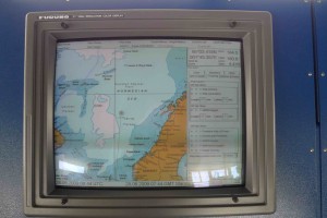
As many people know, I set strange goals for myself.  One was to set foot on the seven continents before I was 25, I did this…Well going below the Antarctic Circle and above the Arctic Circle before I am 30 is another of these goals.  With passing the Arctic Circle this evening at 10:43, I have accomplished this goal! Needless to say, I am very excited so I took a picture next to the map with the location. 


We are now above the Arctic Circle just west of the Voering Plateau…Still steaming…


Day 3- Steaming North


I woke up to a foggy morning with calm seas.  We started the day around 63°N and continue to steam north.  The water temperature is a balmy 8.5°C (47°F) and the air temperature is around 10°C (50°F).  The winds are calm so the fog seems to be sticking with us but the wind is supposed to shift tomorrow so it could clear out some of the fog.  I spent some time on the bridge today and saw some passing schools of mackerel on the surface.  They quickly went below when they sensed the ship coming but it is always nice to see signs of life on the open ocean. 


The rest of the day was spent preparing for the upcoming work which is going to be fast and furious.  I have an early morning wakeup call at 3:30 am to get out on deck by 4:00 for the launching of the CTD (Conductivity Temperature Depth Recorder).  We should be passing through the Arctic Circle shortly.  


Day 2- June 24, 2009


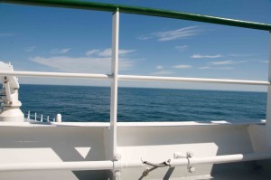
I arose to a beautiful calm morning on the North Atlantic with the Hebrides to the east of the ship.  We are moving at quite a fast clip up to our sampling area, cruising at around 14 knots.  We have a southerly wind behind us adding to our speed and the calm seas are helping us along. 


Because today we are steaming (transiting), the chief scientists gathered all hands to talk about the sampling plan.  It seems we are going to begin sampling just below 68° N where the concentration of post-smolt salmon should be high as they funnel along the western side of the Voering Plateau.  We are anticipating a high catch in this area on our way to the more northerly sampling grounds. 


The rest of the day was spent exploring the ship to find good places and interesting angles to shoot photos and video of the net coming in.   And of course, enjoying the sunshine!  It was quite warm and very beautiful as we traveled up north, with gannets and other sea birds flying all around the ship. 

We have another day steaming tomorrow and should reach our first sampling area on Friday morning.  Because we are heading pretty far north, we may lose internet signal for a few days so the posts will be logged when we are back online.

We are now above 61 degrees North…The science should start soon…I am looking forward to seeing some post-smolts and whatever other species we capture in the nets!  


Day 1- Leaving the Dock


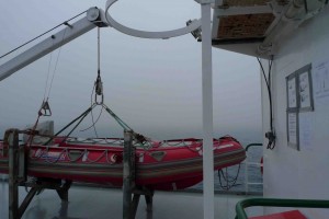
After a day of running around Killybegs getting our final medical certificates needed to go on the voyage, we were back on the ship and ready to set sail for the Norwegian Sea.  Before setting sail, we took the tender, the Tom Crean, out for spin to get some shots of the ship from the water.  It was a lovely day (I could have stayed out all day), but we ventured around the harbor, checked out a few things, and then were hoisted back into position on the ship. 


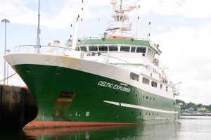
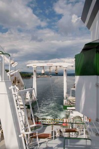
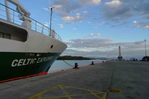
The RV Celtic Explorer

The ship from the Tom Crean. (Thanks Pat for the lift)

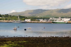
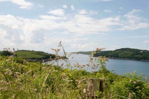
A scenic area in Killybegs


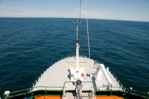
We pulled away from the dock just after 1500 hours (3pm) with calm seas, light wind, and sunshine.  As always, I was up on the bow as we steamed out of the harbor, past the lighthouse and along the Irish coastline.  It was a beautiful voyage for the next few hours as we passed by sea cliffs and hidden beaches. 


Leaving Killybegs


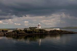
The lighthouse on the way out of Killybegs


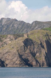
The Cliffs of Slieve League (Sliabh Liag)

Now it is a three-day steam until we reach our first sampling area.  Plenty of time to get acquainted with everyone and the ship…


Personal Sea Survival Training


In order to sail on an Irish research vessel, one must obtain training and certification in personal survival skills.  We were unable to find an appropriate course in the US so we had to get the certification here in Ireland before departing on the expedition.  We found ourselves at the Leisure Park in Westport, Ireland bright and early to take this one-day course.  The course was quite interesting as we learned about all kinds of tools and skills for surviving an emergency at sea.  We also watched footage of real sea disasters, not the best idea for the day before a sea voyage.  Basically we learned about how easy it is to die in cold water but that it all comes down to the proper gear.  Isn’t that the case for nearly everything?  Your “window of opportunity” for survival is increased dramatically if you have the proper gear and know how to use it.

While the first part of the course was in the lecture hall, the second half of the day was in the pool.  Yes, the pool.  We donned our swimsuits and performed all the skills talked about in the morning.  With our life jackets on, yes the uncomfortable orange ones, we paddled around in the pool and learned how to stay warm by huddling together, how to swim together and how to pile into a lifeboat with seven complete strangers.  We became close quickly.  Needless to say, it was an interesting afternoon but nice to know all of these skills. 

With certifications in hand and a new knowledge of how difficult it is to get into a lifeboat in the calm water of a pool, we set off for Killybegs to meet the ship arriving just at sunset.  


The RV Celtic Explorer at Sunset in Killybegs, Ireland


The SALSEA PROJECT- “Lost At Sea” Film


A few months ago, Deirdre Brennan, a fellow member of the Explorers Club, approached me about a film, “Lost At Sea,” she is making with Eamon de Buitlear about Atlantic Salmon and where they go in the ocean once they leave the rivers. The ratio of fish leaving the rivers to those returning has declined dramatically in recent years indicating a high mortality of the salmon at sea. In an effort to learn more about these post-smolt fish, the SALSEA project was created to learn about the oceanic migration of the salmon. Deirdre asked me to come along on one of the SALSEA expeditions to film and assist in the early stages of the film. Being the avid fisherman that I am and of course, my desire to know all there is to know about every fish in the sea, led me to participate on this SALSEA expedition aboard the RV Celtic Explorer into the Norwegian Sea to collect and sample post-smolt Atlantic Salmon on their way to their feeding grounds to the North.

I am very excited to be on this voyage and a part of this project as it is one of the first of its kind to do a comprehensive study of salmon at sea. We will be fishing for the salmon with surface trawls (large nets dragged right at the surface) because the post-smolt salmon, fish just leaving the rivers, are found in only the surface waters no deeper than 3m. Because the scientists are using genetic markers to identify the fish, every fish captured becomes useful as opposed to only tagged fish in the past. There are 1360 known salmon rivers in Europe and many of the highly productive rivers have been “genetically mapped” so that the fish caught in the ocean can be identified to their natal river.

We are heading north to an area west of the Voering Plateau where the salmon funnel into the Barents and Greenland Seas. This “salmon pass” is our target area in our quest to document the salmon migration. In its second year, the SALSEA project will attempt to answer questions of where the salmon go when they leave the rivers and why they are not returning.


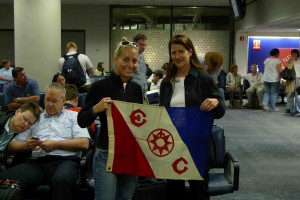
Gaelin Rosenwaks & Deirdre Brennan are carrying Explorers Club Flag #81 on this expedition


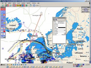
HERE IS LINK TO OUR CRUISE TRACK FROM MY SPOT TRACKER:

MAP


OUT TO SEA!!!


After a bit of time on land, it is time for Gaelin and Global Ocean Exploration to head back out to sea.  We will be embarking on the R/V Celtic Explorer departing from Killybegs, Ireland and heading north into the Norwegian Sea.  Gaelin is honored to be carrying the Explorers Club Flag #81 on this expedition.  

The purpose of the voyage is to track Atlantic Salmon Migration at Sea.  The scientists I will be working with have completed a comprehensive genetic map of the rivers of Northern Europe and now are taking their sampling out into the ocean where they will collect specimens in order to add the ocean migrations into this map.  Understanding where the Atlantic Salmon go once they leave the rivers is of vital importance to creating conservation strategies for this fish prized for food and sport fishing.  

Currently, I am finishing my preparations to fly out to Ireland this evening where I will visit the Marine Institute, get some final safety certifications and then head out to sea on Tuesday.  Stay tuned to the blog for updates about the voyage and the science, and lots of pictures!  


Map of Voyage


We are hoping to be updating on Facebook and Twitter as well.  For Facebook, become a fan of Global Ocean on our page: FACEBOOK LINK.  For Twitter, find us @gaelinr.  

Â